Our Services
- Home
- Our Services
What We Do
Thermal & Asset Inspections
Asset Inspections Solar Panels, Buildings, Infrastructure,
& Rooftops
Surveying
& Mapping
Land Surveying, 2D/3D Mapping, Land Boundary Mark-outs, Terrain, Emissions
Construction
Progress
Fortnightly Site Flyovers, 3D Modelling, Land Surveys, Access to Hazardous Areas
Corporate & Business
Promo, TV, Social Media, Marketing, Advertising, Website Content Production
Overview of Services
Click the headings below to view the services under each heading:
Thermal & Asset Inspections
Thermal & Asset Inspections using drone technology have revolutionised the way industries approach maintenance, safety, and efficiency. By leveraging advanced thermal imaging cameras mounted on unmanned aerial vehicles (UAVs), professionals can now conduct comprehensive inspections of various assets with unprecedented ease and accuracy.
Key applications of thermal drone inspections include:
- Building inspections: Detecting heat leaks, moisture ingress, and insulation defects in commercial and residential structures
- Solar panel and farm inspections: Identifying underperforming panels or cells within large arrays, enhancing overall system efficiency
- Power line and infrastructure inspections: Locating hotspots in electrical systems that may indicate developing faults or hazards
- Environmental and agricultural monitoring: Assessing crop health, detecting irrigation issues, and identifying pest infestations
Thermal imaging drones utilise radiometric sensors to detect heat signatures emitted by objects, allowing for the visualisation of temperature variations across large areas.
This technology enables inspectors to identify potential issues that may not be visible to the naked eye, such as heat loss in buildings, faulty electrical components, or inefficiencies in solar panels.
The advantages of using drones for thermal inspections are numerous:
- Enhanced safety: Inspectors can assess hazardous or hard-to-reach areas without putting themselves at risk
- Increased efficiency: Large areas can be surveyed quickly, reducing inspection time and costs
- Improved accuracy: High-resolution thermal imaging provides detailed data for precise analysis
- Proactive maintenance: Regular inspections allow for early detection of issues, preventing costly failures
As the technology continues to advance, thermal drone inspections are becoming an essential tool across various industries, offering a safer, faster, and more cost-effective approach to asset management and maintenance.
Surveying & Mapping
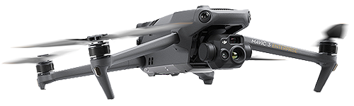
Our advanced DJI Mavic 3T Enterprise drone enables efficient and accurate surveying and mapping services for a variety of projects. Leveraging cutting-edge technology, we offer:
Topographical Surveying
Using our drone’s high-resolution camera and sensors, we conduct comprehensive topographical surveys to capture detailed overviews of land features and terrain. This service is ideal for:
- Site planning and development
- Environmental assessments
- Land management projects
Our topographical surveys provide valuable insights into elevation changes, natural features, and site characteristics, supporting informed decision-making for your projects.
2D and 3D Mapping
Our drone’s capabilities extend to creating 2D Orthomosaic maps and 3D models of surveyed areas. These deliverables offer:
- Visual representations of project sites
- Comprehensive overviews for planning and analysis
Utilising DJI Terra software, we process and render the collected data into high-quality, actionable mapping products.
Key Benefits
- Rapid data collection: Cover large areas efficiently, reducing time and costs
- Enhanced safety: Access challenging terrains without risk to personnel
- Regular updates: Easily conduct repeat surveys to track changes over time
- Cost-effective: Obtain valuable survey data at a fraction of traditional methods’ cost
By harnessing drone technology, we provide you with up-to-date surveying and mapping solutions to support your project needs and decision-making processes.
While our current equipment offers useful capabilities for general site assessments and visualisation, it’s important to note that the topographical data collected has an approximate difference of 1 to 5 meters compared to high-precision surveying methods.
Construction Progress
Our drone-based construction progress monitoring service offers real-time visual data and insights to enhance project management efficiency. Using advanced drone technology, we capture high-resolution aerial imagery and video to provide comprehensive site documentation throughout the construction lifecycle.
Key Features
- High-resolution aerial photography and videography
- Orthomosaic mapping for detailed site planning
- 3D photogrammetry for volumetric calculations and progress tracking
- Regular site updates with customizable frequency (daily, weekly, monthly, etc.)
- Secure online project management portal for easy data access and sharing
Benefits
- Improved project oversight and decision-making
- Enhanced communication with stakeholders
- Early detection of potential issues or delays
- Accurate documentation for quality control and compliance
- Increased safety by reducing the need for manual inspections
Our CASA-Accredited, Licensed and Certified Remote Pilots utilise commercial-grade equipment, including the DJI Mavic 3T (Thermal) Enterprise drone, to ensure the highest quality data collection. All aerial data is processed using industry-standard software to provide CAD-compatible outputs for seamless integration into existing workflows.
Service Options
We offer flexible monitoring schedules to meet your project needs:
- Daily updates for critical phases
- Weekly progress documentation
- Bi-weekly site surveys
- Monthly comprehensive reports
- Quarterly 3D modelling and volumetric analysis
Deliverables
- High-resolution aerial images and videos
- Orthomosaic maps of the construction site
- 3D models for volumetric calculations
- Progress reports with annotated imagery
- Secure online access to all project data
Pricing is customised based on project scope, frequency of monitoring, and specific requirements. Contact us for a tailored quote to support your construction progress monitoring needs.
Corporate & Business
Our services offer comprehensive corporate and business drone imaging services, leveraging our expertise in aerial imaging, marketing, advertising, and graphic design. Our solutions are tailored to elevate your brand and enhance your visual communications across various platforms.
Aerial Marketing Content
- High-resolution aerial photography and videography for corporate marketing materials
- Stunning drone footage for commercials, promotional videos, and social media content
- Aerial tours of corporate campuses, manufacturing facilities, or project sites
Graphic Design & Branding of imaging content
- We work with high level brands and guidelines, brand identity can be developed or applied to imaging content
- Imaging for marketing content creation (websites, social media, presentations, pitches and stakeholder updates)
- Custom infographics and data visualisation
- Digital Marketing content including social media, email marketing content creation
- Website content
Advertising Campaigns
- Conceptualisation and execution of aerial-focused ad campaigns
- Integration of drone footage into TV commercials and online ads
- Billboard and large-format print ad design featuring aerial perspectives
Corporate Event Coverage
- Aerial documentation of corporate events, conferences, and product launches
- Live streaming capabilities for virtual event experiences
- Post-event highlight reels and promotional materials
Virtual Tours & 3D Modelling
- Interactive virtual tours of properties or facilities using drone imagery
- 3D modelling of products or structures for marketing and presentation purposes
Our team combines technical drone expertise with creative marketing skills to deliver impactful visual solutions that set your business apart. Whether you need a complete marketing overhaul or specific aerial content for your next campaign, Professional Drone Imagery has the tools and talent to bring your vision to life.
How do drone and traditional aerial imaging compare?
Learn how drone imaging compares to traditional aerial imaging, the benefits and cost savings for your business or project.