01
Advanced Insights
Commercial industries demand the need for precise aerial data and imaging. Businesses seek advanced drone solutions for thermal imaging, surveying, mapping, and photography to gain insights and make data-driven decisions.
02
Quality Imaging
Drone technology innovates visual storytelling and marketing. Our high-resolution aerial imagery and video capture cinematic perspectives, creating compelling content for real estate, tourism, and event promotion across multiple platforms.
03
Cost & Safety Benefits
Aerial imaging with drones reduces costs and risks replacing traditional methods, minimising hazards, cutting expenses, and improving efficiency while prioritising safety. This innovative approach offers safer, cost-effective data collection across many industries.
welcome
About PDI
Professional Drone Imagery Pty Ltd (PDI) is your local Illawarra provider of specialised commercial drone services, delivering high-precision aerial imaging and data to businesses that demand excellence.
Our CASA-Accredited, Licenced and Certified Remote Pilots harness advanced drone technology, including thermal imaging, surveying, mapping, photography and videography capabilities, to capture detailed aerial assessments and imagery across the Illawarra, Shoalhaven and Southern Highlands regions of NSW. We are a member of the Australian Association for Uncrewed Systems (AAUS) and manage our fleet and equipment with AirData UAV for live data on the maintenance and status of our equipment for safety and regulatory compliance.
We transform this raw data into valuable geospatial information and comprehensive analytics, servicing a diverse range of civil, industrial, and government projects that require regular, in-depth aerial insights.
At PDI, we focus on driving business decisions and enhancing operational efficiency through our commercial applications.
Our specialised drone expertise extends beyond mere data collection, offering thermal analysis, topographic mapping, and professional aerial imagery that provide our clients with a competitive edge. By leveraging our services, businesses gain invaluable insights that inform strategic planning, optimise resource allocation, and unlock new opportunities in their respective fields.
Choose PDI to elevate your perspective and propel your projects to new heights with our unparalleled aerial intelligence solutions.
30+ Yrs
Years expertise in photo, video & surveying
$20 mil
Public Liability Insurance Underwriter QBE
2 Pilots
CASA-Accredited, Licenced & Certified Remote Pilots
why pdi?
Why choose us?
We are an Australian-owned and operated small business based in the Illawarra. Your trusted local partner for specialised commercial drone aerial services on the south coast of NSW.
Our tailored approach ensures high-quality, actionable data to support informed business decisions, large or small.
Thermal & Asset Inspections
Asset Inspections Solar Panels, Buildings, Infrastructure,
& Rooftops
Surveying
& Mapping
Land Surveying, 2D/3D Mapping, Land Boundary Mark-outs, Terrain, Emissions
Construction
Site Progress
Fortnightly Site Flyovers, 3D Modelling, Land Surveys, Access to Hazardous Areas
Corporate & Business
Promo, TV, Social Media, Marketing, Advertising, Website Content Production
our crew
cASA-Accredited, Licenced
& certified Remote Pilots
Our CASA-Accredited, Licensed, and Certified Commercial Remote Pilots bring experience in photography, videography, construction content, mapping and surveying and more. With expertise in innovative drone solutions, we deliver commercial-grade aerial drone services tailored to your business or industry needs.
our work
Projects
Explore our latest drone projects: solar panel and roof inspections, property aerial photography, and more.
Our images showcase precision, versatility, and the cutting-edge technology we bring to every job.
Our images showcase precision, versatility, and the cutting-edge technology we bring to every job.
Survey mapping
Survey mapping
Thermal inspection roof Professional Drone Imagery Pty Ltd
Thermal inspection roof Professional Drone Imagery Pty Ltd
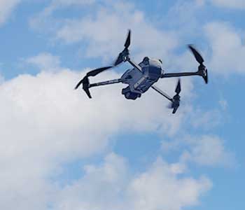
DJI Mavic 3T Drone
DJI Mavic 3T Drone
Solar Panel Roof
Solar Panel Roof
Aerial property photograph Professional Drone Imagery Pty Ltd
Aerial property photograph Professional Drone Imagery Pty Ltd
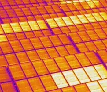
Thermal Inspection Solar Panels
Thermal Inspection Solar Panels
OUR blog
DroneScope
Stay informed with Professional Drone Imagery's blog "DroneScope". Here we'll share updates on drone tech, airspace regulations, and industry trends to help your business keep informed.
Learn about our latest services and innovations, and how we're adapting to serve you better. From CASA changes to new aerial imaging applications, we provide the insights that matter most to our clients.
Learn about our latest services and innovations, and how we're adapting to serve you better. From CASA changes to new aerial imaging applications, we provide the insights that matter most to our clients.
Night Flying
Considering Night Flight Drone Services? Key Insights for Businesses
Considering a night aerial drone project but unsure where to start? Let’s demystify the process…While recreational flying
Prodrone
10/02/2025
Industry Insights
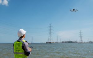
Drone Industry Soars: Australia’s Aerial Growth Takes Flight
The Drone industry in Australia is experiencing unprecedented growth, presenting exciting opportunities for remote Drone (UAV/RPA) operators
Prodrone
17/01/2025
Construction
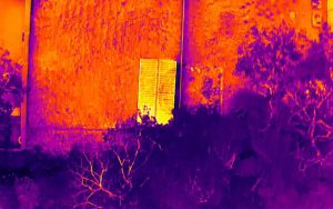
Benefits of Thermal Imaging in Industrial Inspections
Learn about the advantages of thermal imaging in industrial inspections. This advanced technology identifies hidden issues before
Prodrone
31/12/2024
OUR locations
Services locations
We are locally based in the Wollongong area, servicing the Illawarra, Shoalhaven, and Southern Highlands regions.
Our services cover from suburban to rural areas along the south coast and hinterland.
Our services cover from suburban to rural areas along the south coast and hinterland.

