FAQ
- Home
- FAQ
frequently asked questions
Can't find what you're looking for? Contact us for personalised assistance.
General Questions
PROJECT GOALS AND OBJECTIVES
What is the primary purpose of this aerial imaging project?
We aim to understand whether your focus is on thermal inspections, content creation, or another application to guide our approach effectively.
What specific outcomes are you looking to achieve with drone imaging?
We’ll clarify if your goal is to detect thermal anomalies, create promotional content, or gather data for analysis.
TECHNICAL AND OPERATIONAL DETAILS
Are there specific areas or structures you want to focus on during the drone flights?
Identifying key targets helps us plan optimal flight paths and camera settings.
What are the environmental conditions of the site
Understanding potential obstacles like weather or terrain helps us prepare for safe operations.
EQUIPMENT AND CAPABILITIES
Do you require high-resolution thermal imaging or standard visual content?
We’ll determine if your primary need is for detailed thermal data or high-quality video/photos for marketing purposes.
Are there any specific features of our drones you wish to utilise?
For example, we can use the Mavic 3T’s thermal or mapping capabilities, the Avata for cinematic scenery shots or the Neo’s AI follow tech for dynamic content for socials.
REGULATORY AND SAFETY COMPLIANCE
Do you know if there is a need to operate in a restricted or controlled airspace?
We’ll check current aviation charts to determine if your project is within restricted or controlled airspace. If not, no additional approvals are needed unless requesting Beyond Visual Line of Sight (BVLOS), Extended Visual Line of Sight (EVLOS), or flying within 30 metres of people.
We’ll assess the viability of requesting approvals based on your project needs, considering associated costs and timelines.
Are there any safety protocols or restrictions we should be aware of?
We conduct a full safety and risk assessment to ensure all risks are recorded and mitigated.
We consider factors such as high voltage powerlines, frequency interference, endangered flora and fauna, local council restrictions, dams, military zones, marine, wildlife and nature reserves, national parks, and police and government locations.
Special approvals are required for areas affected by fire, flood, or damage, as well as high populous areas or events.
DELIVERABLES AND TIMELINES
What type of deliverables do you expect from this project?
We’ll clarify whether you need raw data, CAD compliant files, processed images, video content, or detailed reports.
What is your timeline for project completion?
Establishing deadlines helps us schedule flights and processing time effectively.
Please note: Projects within 3 nautical miles (5.5km) of an aerodrome or heliport require CASA approvals/permits, which can take up to 72-100 days and incur additional costs. Some locations may also require council permits. Some permits do have costs involved and will be added to the invoice and itemised for transparency.
BUDGET AND RESOURCES
What is your budget for this project?
Understanding your financial budget allows us to tailor our specialised commercial imaging services accordingly, considering the complexity of data collection, processing, and specific requirements involved.
Our aerial imaging services are specialised and for commercial business operators who hold a current ABN, industry and government clients.
If requested, we will provide an itemised quote based on the project brief along with a service agreement to ensure all parties are clear on expectations, this will need to be signed and accepted prior to job commencement.
By asking these questions, we can better understand your business needs and tailor our drone services to meet your specific requirements effectively.
Every project will require the following:
- A signed service agreement outlining the terms and conditions of the project.
- The project outline which will be created from the project brief you provide and discussions we have.
- It will include all deliverables, file and document formats, and any relevant and important information prior to the job commencing.
- It will outline when you will receive your photos, videos, images or data.
- It will also include the process we are required to follow by CASA for your reference.
Great question! As we are based in Corrimal, in the Wollongong area, we are focused on the following service areas (100Kms radius of each CBD):
- Illawarra
- Shoalhaven
- Southern Highlands
If your location is not within these regions, contact us to discuss your project. If we are unable to do the job, we may be able to refer you to someone within your area or other ways to find a drone operator in your are.
Payment & Terms
- After discussing your project requirements, we’ll provide a detailed quote.
- Once you accept the quote, we’ll issue an invoice with clear payment terms and information.
- The quote will be emailed to you electronically via our Quickbooks accounting system.
- There you will be able to accept the quote online then an Invoice will be generated and sent for payment (either deposit or in full).
- Payment terms are outlined on each invoice.
- Depending on the project and sign contract services agreement, we may require a 50% deposit before starting the job.
- The remaining 50% payment will be requested and due before we release images or data to you.
Yes. $50.00 + GST per week after due date, until the invoice is fully paid.
Please note: If there are two or more late payments on separate invoices for your company, all future jobs will require upfront full payment. Or, we may decide to not provide services to your company, this will be at our discretion.
Our preferred payment method is Direct Deposit or EFT.
- To pay via credit card, you can pay via your account bank using PayID.
- PayPal and Cash are accepted.
- Cheques are not accepted.
Please use the following banking details:
Name: Professional Drone Imagery Pty Ltd
Bank: Commonwealth Bank
BSB: 067-873
Account: 1210 3633
Reference: Please write the Invoice Number which is located at the top right of the invoice so we know you have paid.
Drones & Flying
Yes! Professional Drone Imagery Pty Ltd is fully CASA-Accredited, Licenced and Certified to operate drones commercially within Australia.
Our team consists of two qualified Remote Pilots, ensuring we meet all regulatory requirements for commercial drone operations in Australia.
Heather James
CEO/Director/Trainer
Chief Remote Pilot (ARN: 1254741)
- ReOC – Remotely Piloted Aircraft Operator Certificate (ReOC No: 8871 ARN: 1260352)
- RePL – Remote Pilot Licence
- AROC – Aeronautical Radio Operator Certificate
Daniel James
Director
Remote Pilot (ARN: 1260096)
- ReOC – Remotely Piloted Aircraft Operator Certificate (ReOC No: 8871 ARN: 1260352)
- RePL – Remote Pilot Licence
- AROC – Aeronautical Radio Operator Certificate
As certified operators, we adhere to stringent safety regulations and can apply for special approvals from CASA for complex tasks such as some night operations, flights in controlled airspace, and BVLOS/EVLOS operations. We are authorised to operate at night while maintaining VLOS under our ReOC: 8871.
This expands our operational capabilities and enhances our potential project scope.
Additionally, we carry comprehensive insurance coverage with $20 Million Public Liability insurance with Drone-use Insurance underwritten by QBE, protecting our clients from potential liabilities.
Our professional qualifications and adherence to regulations ensure that we can provide safe, legal, and high-quality drone services for a wide range of commercial applications.
Great question! Before accepting any project, PDI conducts thorough research on the proposed location and airspace classifications to ensure compliance with all regulations.
Our process includes:
Consulting the Visual Terminal Charts (VTC) and En Route Charts (ERC) provided by Airservices Australia to identify controlled airspace, restricted areas, and other relevant airspace information.
Checking the AirServices Australia, CASA and OK2Fly and other up to date resources for detailed information on restricted areas and their activation times.
Using the AirServices Australia website to access up-to-date airspace infringement maps and hotspots, helping us identify areas of particular concern.
Assessing the proximity to aerodromes, helipads, and other sensitive areas that may impact drone operations.
Investigating any temporary flight restrictions or NOTAMs (Notice to Airmen) that could affect the project area.
Evaluating the need for special permissions or exemptions from CASA for operations in controlled airspace or restricted zones.
By conducting this comprehensive analysis using official aviation resources, we determine whether a project is viable or if restrictions make it unfeasible. In cases where permits are required, we handle the application process to ensure all operations are fully compliant with Australian regulations. We will inform you if any permits are required for your project.
This proactive approach allows us to provide clients with accurate information about potential limitations or additional requirements before committing to a project.
The laws for flying a drone in Australia are designed to ensure safety and protect privacy.
Key regulations include:
- Maximum altitude of 120 meters (400 feet)
- Minimum distance of 30 meters from people, buildings, and vehicles
- No flying in restricted airspace like near airports or military bases
- Visual line-of-sight operation only
The Civil Aviation Safety Authority (CASA) regulates drone operations in Australia. CASA issues licenses and certifications to drone pilots, sets operational rules, and works with other agencies to investigate incidents.
For commercial drone use, operators need a Remote Pilot Licence (RePL) and Remotely Piloted Aircraft Operators Certificate (ReOC) and must follow additional safety regulations.
Drones over 250 grams must be registered with CASA.
Penalties for violating drone laws can include fines up to $11,000 or imprisonment for up to 2 years, depending on the severity of the violation.
Operators are required to always prioritise safety and be aware of potential risks when flying drones.
Safety is paramount in drone operations, especially on construction sites and other industrial environments. In addition to our comprehensive safety protocols and regulatory compliance, we ensure that all necessary safety equipment and signage are in place during our operations.
This includes:
- Personal Protective Equipment (PPE)
- Site Safety Equipment
- Signage
- Communication Devices (VHF Radio)
- Weather Monitoring Equipment
- Fire Safety
By implementing these safety measures, we not only comply with regulations but also demonstrate our commitment to creating a safe working environment for our team and clients. We provide VHF radio communication on every mission to communicate with mission observers or Air Traffic Control where required. This comprehensive approach to safety enhances the professionalism of our operations and provides peace of mind to all stakeholders involved in the project.
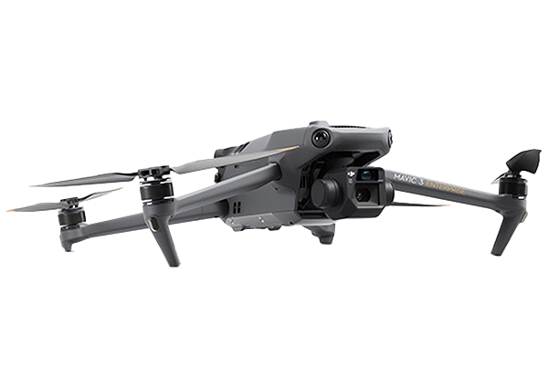
DJI Mavic 3T (Thermal) Enterprise
This versatile drone combines high-resolution 4K imaging with thermal sensing technology, making it ideal for a wide range of applications:
- 4/3″ CMOS wide camera for detailed aerial photography and videography
- 12MP, 162mm equivalent focal length camera with 56× hybrid zoom
- 640×512 thermal camera for heat signature detection
- Point and area temperature measurement capabilities
- High temperature alerts for safety monitoring
- Colour palettes and isotherms for enhanced thermal analysis
- Side-by-side 28× continuous zoom for thermal and visual comparisons
- Extended flight time of up to 45 minutes
- Optional RTK module for centimeter-level accuracy in mapping and surveying
- DJI O3 Enterprise transmission system for stable, long-range control
The Mavic 3T is particularly suited for:
- Construction site monitoring
- Infrastructure inspections
- Energy efficiency analysis
- Environmental assessments
DJI Avata 2
This compact and agile drone excels in capturing immersive footage in tight spaces:
- Designed for both indoor and outdoor use
- High-quality camera
- Obstacle avoidance sensors for safer indoor flights
- Compact size allows for unique perspectives and manoeuvrability
- Ideal for real estate interior shots and detailed inspections in confined areas
The Avata 2 is particularly useful for:
- Indoor real estate photography and videography
- Detailed inspections in confined spaces
- Creating dynamic marketing content
- Capturing unique perspectives for creative projects
DJI Neo
This drone offers a balance of portability and performance, with special features tailored for social media content creation:
- Lightweight and portable design
High-quality camera for aerial photography and videography
“Follow me” function for dynamic tracking shots - Automated flight modes for creative shots
- Suitable for both internal and external uses on construction sites
- Perfect for conducting engaging site walkthroughs
The DJI Neo is particularly effective for:
- Social media content creation
- Construction site documentation
- Real estate marketing
- Event coverage and promotional videos
By utilising our diverse fleet of drones, we can offer tailored solutions for a wide range of commercial applications, ensuring that we meet the specific needs of each project with the most appropriate technology.
Services
- Aerial Photography
- Aerial Videography
- Thermal Imaging
- 2D/3D Modelling
- Data Collection
- Volumetric scanning
- Solar Panel Inspections
- Roof Inspections
- Asset Inspections
- Insurance Assessor reporting content
- Topographic Mapping
- Aerial Surveying
- Tourism and scenic content
- Construction progress
- Time-lapse Capture
- Ground-based Content
- Marketing and social media content creation
- Tenders, presentations and proposals, marketing promotional videos.
- Graphic design, animations, dynamic intros, video editing, stock library curation and research
- AI based aerial 3D video content for locations where we can’t fly due to CASA Regulations (controlled aerodromes, military zones etc)
We can manage all content creation, social media audits, set up, online ads, reporting and management of your social media with ongoing support, content management, scheduling and all creative services related.
We do not service search and rescue or pro bono services.
Yes!
We currently have Solar & Roof Inspection packages
Our Trades Packages are in development as we speak!
Most of our work is tailored to each client, but packages are a great way to bundle services together.
Our work is mostly remote and on location. However, we do work from our office in Corrimal and where agreed in a service level agreement with clients, we can and do work from our clients offices or on-site. It depends on the requirements and the agreed service. Talk to us about your project and how can best service your business requirements.
Great question, we work that out with each client and project based on budget and project timelines.
As a guide, videos can be filmed and given to our post production team for processing with a 24-48 hour delivery. This is based on one video per day.
Photographs can also take the same amount of time for post production. Where content doesn’t require editing i.e. insurance raw imaging, we provide content the same day.
Let’s talk about what your project requires, what your budget is, urgent or rushed content can incur higher rates and charges.

